

Moon 2050
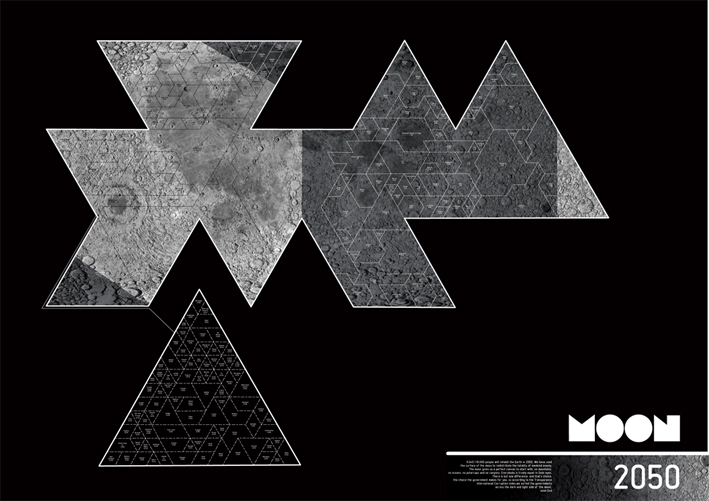
Look at a photo published today (can be found anywhere) and predict a scenario 50 years in the future. That is what Marjolein Coenray and I did with a picture from a lunar satelite. We tought about the moon, and started with colonisation. But that was too far fetched, so we diled it down and tried to extrapolate the way earth has worked with territory, taking it.
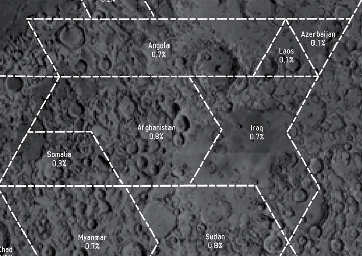
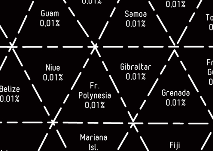
The poster depicts a Dymaxion map type. We chose this type of cartography because it does not stretch land as a normal map does, nor does it displace terrain. (and it is also a cool looking shape).
We calculated the total amount of terrain, divided it by every citizen of every official state on the planet, gaining a number. We used this in the end to devide the moon into equel shares for every living person on earth, sorted into states.
Specifics
Poster
594 x 420 mm
2009